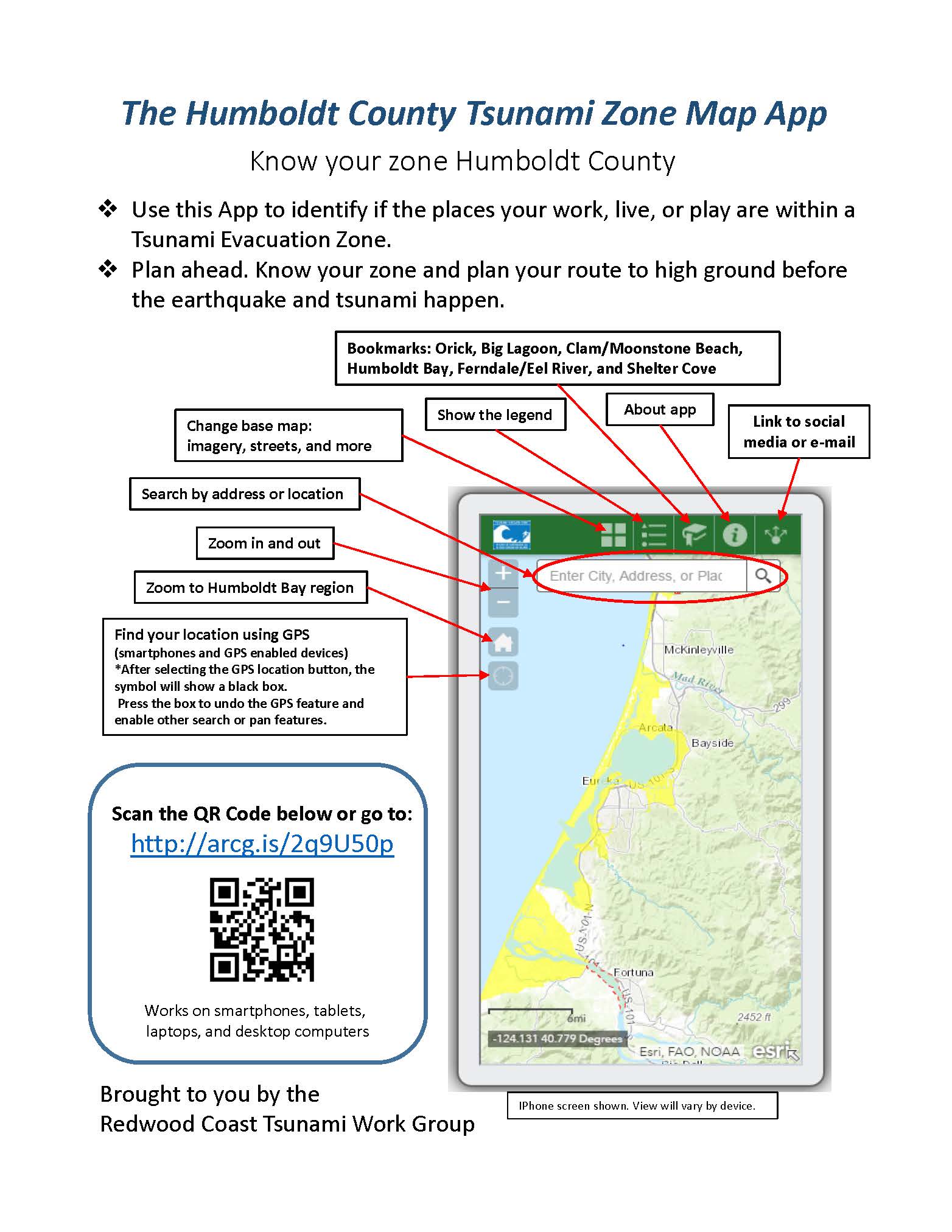
Humboldt County now has a free Tsunami App! Check it out at http://arcg.is/2q9U50p.
Todd Becker, Environmental Analyst for the Humboldt County Department of Public Works and member of the Redwood Coast Tsunami Work Group has developed an app for use on phones, tablets and computers to help you find tsunami zones around the county. From there, you can tell whether the tsunami zone is close to where you live, work, play or any other location.
The app features the county’s current tsunami maps which are based on the worst tsunami threat for our area - a magnitude 9 earthquake on the Cascadia subduction zone.
“The goal for the app was to take the existing Tsunami Hazard Zone data previously used to create printed maps and make it accessible and dynamic through an online interface,” Becker said. “For example, when used with a smart phone, the device’s GPS can be accessed to zoom in to your current location for determining if you are in the Tsunami Hazard Zone. Many of us carry these devices with us everywhere we go. You can use this app as part of your emergency preparedness planning for your home, work, school, and places of recreation.”
Note - the maps in this app or our other tsunami brochures and information show areas of safety (white) and areas where you could be at risk (yellow). They do not show where the water will reach in a particular tsunami event. They are a tool to help you develop a tsunami plan. If you are anywhere in the yellow area and feel an earthquake that lasts a long time (more than 20 seconds), head to the nearest white area on foot and stay away until informed it is safe to return.
The app is still under development. The current version requires internet connectivity. In the future, it will be possible to download the map info and view at a later date without being online.